
Alpine hiking - Himachal Pradesh to Uttarakhand 2023
- Sant Mote
- Jul 10, 2023
- 5 min read

Updated: Jul 14, 2023
A 21 day alpine style ultra hike covering 320 kms across 13 high altitude mountain passes in Kullu, Shimla, Uttarkashi and Tehri Gharwal districts of Himachal Pradesh and Uttarakhand with a total elevation gain of 32,565 meters.

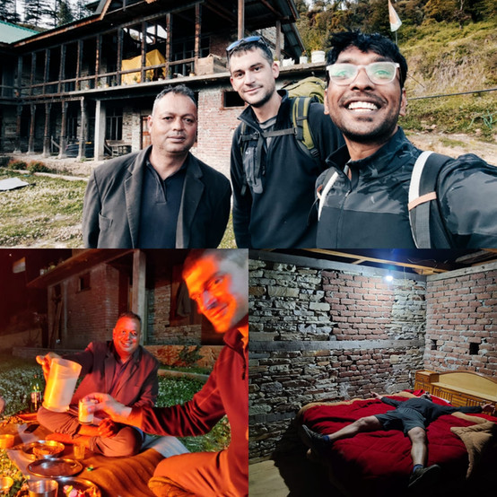
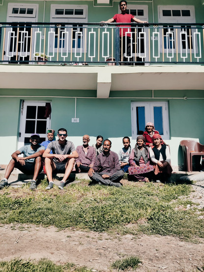
Photo by Avish Vish
The plan - How it all started
Fresh after completing Peter Van Geit's 7 day Alpine Field Boot Camp in Manali where I learnt about Himalayan terrain, navigation using offline maps, traverse planning, minimalist hiking and a whole lot of other outdoor survival skills I was eager to put my learnings to the test and take off on my own adventure exploring remote corners of the Himalayas.
The naive idea of hiking from Kullu to Uttarakhand sounded exciting (not knowing if it was doable). With Peter's help we planned a route heading in south-east direction towards Kedarnath. Thus began my journey of alpine hiking from Himachal pradesh to Uttarakhand.
Criteria & challenges of planning a 300+ km traverse in Himalayas
One major criteria while planning the route was to pick mountain passes below 4000 meters as hiking in deep snow on higher elevation would present a daunting and potentially risky challenge.
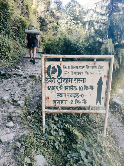
Once we identified a viable route across 13 mountain passes below 4000 meters of elevation we had another challenge to overcome- many of the lower passes had not been mapped on Open Street Maps yet. I saw this as a great oppurtunity to explore unchartered territory using Survey of India maps and contribute GPS accurate trails to the growing Open Street Map community in hopes of establishing a long and continious hiking trail stretching 300 kms across the foothills of the Western Indian Himalayas.
Tools and minimalist hiking strategy
Offline Mobile Navigation - I used OSMAnd and Survey of India maps on my phone for navigation and planning. I downloaded maps of Himachal Pradesh and Uttarkhand along with the contour lines of the topography. This helped me stay confident in remote locations, with accurate info about small hamlets in the valleys to restock food, details about about water sources, planning the hike based on distance and elevation gain. Resource for using offline mobile maps: https://ultrajourneys.org/alpine-style-hiking-mobile-navigation/ https://ultrajourneys.org/exploration-through-survey-of-india-maps/
Minimalist Gear - I carried a 30l backpack with only the essentials to reduce excess weight in order to move fast and comfortably in the challenging Himalayan terrain allowing me to hike an average of 20kms with 1500 mts of elevation gain everyday. This included an outer cover of a 2p tent (400g) with a hiking pole to setup, dry fit clothes, puff jacket, sunglasses, rain coat, powerbank, sleeping bag, mat and a disposable 500ml bottle.

Resource for minimalist packing:
https://ultrajourneys.org/minimalist-packing/
Food, Rest & Recovery - The hiking route was planned in a way where I would start from a village at the base of the mountain early in the morning, hike up to a mountain pass and descend to a village/hamlet on the other side of the valley by evening. Offline maps helped in marking settlements on the way. I would carry enough food and snacks to last me till I reached the next village. Eating freshly cooked meals at villages and sleeping at lower altitude made it easy to recover from long hikes. Keeping me refereshed for the next days hike.
Weather forecasts - I used Windy to check for weather forecast whenever I had access to internet. Although not entirely accurate it helped in planning my route for the next 2-3 days. If the weather was unpredictable I would avoid high altitude passes and pick an alternate route.
Mapping lesser known parts of Himalayas
An invaluable resource for my exploration journey was the 200 year old British Survey of India map. The map includes terrain details, forest boundary, names of remote human settlements and countless hiking trails. I would often use it while conversing with locals to enquire about routes to remote hamlets and they would point to a trail used by shepherds. Many times the centuries old map was accurate within 100 meters and sometimes it would send me off trail into dense/steep jungles. Which I had come to accept was a part of the adventure when you are exploring new routes.

This exploration mission proved to be quite successful as we were able to accurately map 8 new hiking trails to mountain passes below 4000 meters, connecting many river valleys across 4 different districts. Routes were recorded using GPS on phone and sent to my team to be uploaded to Open Street Maps for future independent hikers to access.
Marking points of interest
While on hikes I would mark useful information like springs, shelters, caves and campsites which I passed along the route. This information comes in handy for other independent hikers to plan their own traverse- deciding where to camp based on availibility of drinking water or even to take refuge under a cave shelter when there is a storm.

Map of my journey
Find the map below with waypoints of mountain passes and villages where one can resupply food or halt for the night.

List of mountain passes on the traverse

Stat summary

Total Distance | Total Ascent | Total Descent |
320kms | 32,565 m | 31,436 m |
Phase 1 - Traverse from Kullu to Shimla, May 12th - 15th
The Kullu traverse began from Garsa at the base of the Hurla Nala and headed towards Sainj via Kandi galu, over Shakranda Galu and Basleo Pass in the Great Himalayan National Park. The route passes through Hurla Nala, Jiwa Nal, Sainj river, Tirthan river and Kurpan Gad.


Find more details about the Kullu to Shimla traverse with hiking routes at the link below
Phase 2 - Traverse from Shimla to Uttarkashi, May 16th - 26th
The Shimla traverse began from Gharola at the base of the Sutlej river and headed towards Taklech via Shrai Koti, over Sarota Ghati, Maral Kanda and Kushmulti Mund to cross the state border of Himachal Pradesh to Uttarakhand. The route goes through Sutlej river, Nogil Gad, Pabbar river and Rupin river.


Find more details about the Shimla to Uttarkashi traverse with hiking routes at the link below
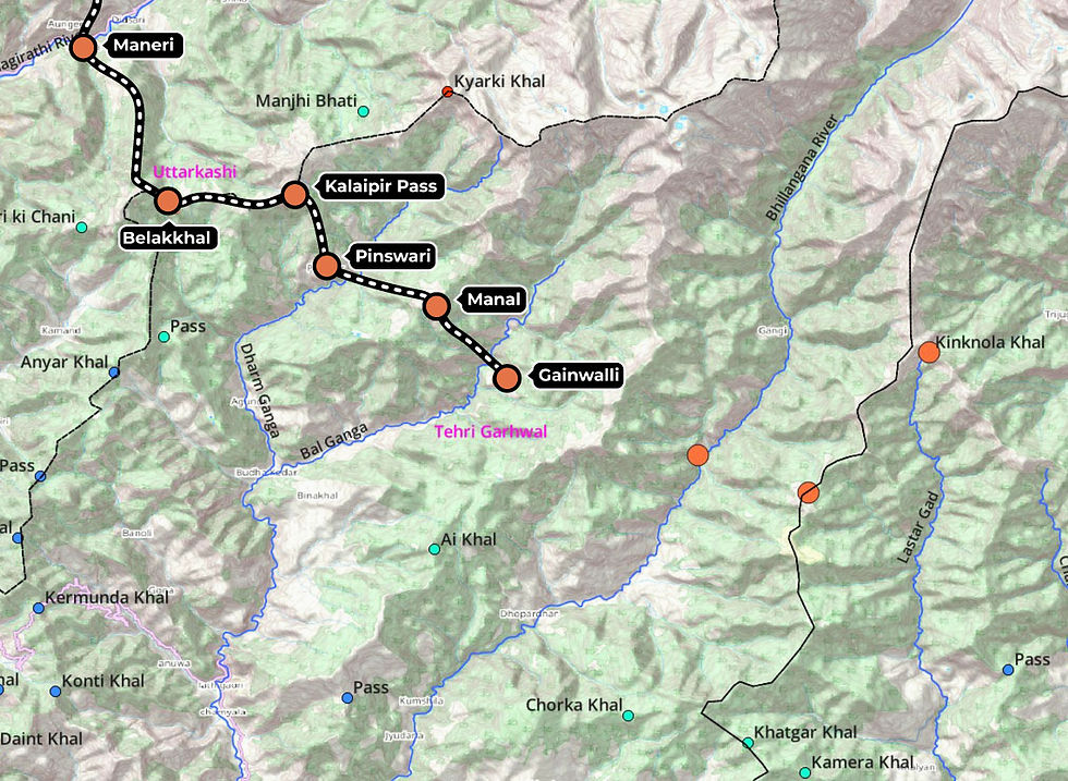
Phase 3 - Traverse from Uttarkashi to Tehri Garhwal
The Uttarkashi traverse began from Newtar at the base of Rupin river and headed towards Barkot via Kedarkantha, over Palachu Pass, Dayara Pass and Belakkal pass. The route goes through Rupin river, Tons river, Yamuna river, Binsi Gad and Bhagirati river.


Find more details about theUttarkashi to Theri Garhwal traverse with hiking routes at the link below
Phase 4 - Traverse of Tehri Garhwal (incomplete)
The Tehri Garhwal traverse began from Bellakhal to Pinswari via Kailapir pass, over Malan to Gainwalli. The route goes through Dharm Ganga river and Bal Ganga river. I had to turn back due to personal reasons leaving Muneri Pass and Kinknola Pass incomplete.


Find more details about the Tehri Garhwal traverse with hiking routes at the link below


Inspirational to read, and it's great that you're sharing data on the route to help fill in the gaps on the map!